How big is your footprint? -
In honor of Earth Day and at the recommendation of Holly I decided to check out what my ecological footprint is. I went to http://www.myfootprint.org/ and took their online quiz. It turns out that my life style requires 14 acres, and that if everybody were to live like me it would take 4.5 Earths. Ouch!! However, I'm still doing better than the average American who uses 24 acres per person.
Thursday, April 26, 2007


Tahoe Regional Planning Authority reverses decison about North Bowl Expansions
 North Bowl Trees Saved -
This week during a re-hearing the Tahoe Regional Planning Authority reversed its decison to allow Heavenly to cut the North Bowl old growth to allow for a high speed chairlift. As of now, they are leaving it up to Heavenly to choose between Alternative 4A- The kinked lift, and Alternative 5 - Replace existing lifts with high speed quads. This is a victory in the Tahoe Basin, and an amazing demonstration of how impactful community organizing and grass roots efforts can be. Not only was the board meeting room completley packed with concerned local citizens yesterday, but they had to set up an overflow room with video-conferencing - and the overflow room was also standing room only. Pretty amazing!
Monday, April 23, 2007
Poster takes third place in College of Science contest
Avalanche Terrain Poster takes third -

Last semester Tim Weigel and I took a class from Gary Raines of the USGS about modeling using GIS. We learned about weights of evidence, fuzzy logic, and artificial neural networks. Tim and I did a project in collaboration with Randall Osterhuber at the Central Sierra Snow Laboratory in which we used weights of evidence to model avalanche terrain in watersheds adjacent to two watersheds that had been heavily studied.
We entered the poster that we made for class in the 2007 College of Science poster competion and took third place. I'm planning on giving a talk at the Nevada GIS conference at South Lake Tahoe next month about this project. Below is a snapshot of the poster. Click on the image for a larger view. I intend to update the image with a better one sometime in the near future.
We entered the poster that we made for class in the 2007 College of Science poster competion and took third place. I'm planning on giving a talk at the Nevada GIS conference at South Lake Tahoe next month about this project. Below is a snapshot of the poster. Click on the image for a larger view. I intend to update the image with a better one sometime in the near future.

Friday, April 06, 2007
Spring in Full Bloom
Spring Arrives in Reno -


Spring is in full bloom here in Reno! Never before have I lived in a city with so many cherry trees. It certainly came as a big surprise, since cherry blossoms are not usually what people associate with Nevada. The university campus, in particular, is beautiful this time of year. The large elm trees that line the historic quad have leafed out and the grass is a brilliant green. Holly and I are beginning to prepare the garden for summer.
The photograph on the left is of daffodils that our neighbors have planted. The photograph on the right is of the tree next to our house.


Spring is in full bloom here in Reno! Never before have I lived in a city with so many cherry trees. It certainly came as a big surprise, since cherry blossoms are not usually what people associate with Nevada. The university campus, in particular, is beautiful this time of year. The large elm trees that line the historic quad have leafed out and the grass is a brilliant green. Holly and I are beginning to prepare the garden for summer.
The photograph on the left is of daffodils that our neighbors have planted. The photograph on the right is of the tree next to our house.
Tuesday, April 03, 2007
Climbing at Sugarloaf and River Rock
Climbing at Sugarloaf and River Rock -
The last couple of weekends I've discovered new climbing spots here in the Reno/Tahoe area. The first was Sugarloaf, which lies just west of Lover's Leap along Highway 50. Sugarloaf is an old school crag climbed by the likes of Warren Harding in the 1950s. It features an incredible variety of chimneys, cracks, and off-widths and has a surprisingly Yosemite-like feel. The area is southfacing and is great for early season climbing.
The second locale is River Rock. River Rock is located just outside of Verdi about 2 miles past the California border. Although it is a relatively small area it has great routes, quality rock, and is located in a nice spot near the Truckee River. More information about River Rock can be found at the following website:
http://harter-climbing.aci.net/riv.html
The last couple of weekends I've discovered new climbing spots here in the Reno/Tahoe area. The first was Sugarloaf, which lies just west of Lover's Leap along Highway 50. Sugarloaf is an old school crag climbed by the likes of Warren Harding in the 1950s. It features an incredible variety of chimneys, cracks, and off-widths and has a surprisingly Yosemite-like feel. The area is southfacing and is great for early season climbing.
The second locale is River Rock. River Rock is located just outside of Verdi about 2 miles past the California border. Although it is a relatively small area it has great routes, quality rock, and is located in a nice spot near the Truckee River. More information about River Rock can be found at the following website:
http://harter-climbing.aci.net/riv.html
Thursday, March 22, 2007
Rock Climbing at Owen's River Gorge
 Rock Climbing at Owen's River Gorge -
This past Friday I found myself traveling down to Owen's River Gorge outside of Bishop, California to do a little bit of sport climbing. The weather turned out to be perfect. Sunny skies with cool morning, warm daytime temps, and cool evenings. We opted to camp at the free campground up the road. This trip was the first significant outdoor climbing trip of the season for me.
We arrived after about a four hour drive from Reno in time to catch a few 5.9s on the left side of the Great Wall of China. After the sun caught up with us we switched over to the Warm Up Wall to finish the day. The following day we caught some great climbing on a climb named Paradise (5.9) followed by a nearby 10c arete and a 5.7. We moved over to the more crowded Pub Wall and did several climbs there before moving on to the Negress Wall and back to the Warm Up Wall. Our final day finished with a 10a, 10b, and three 9s all on the left hand side of the Great Wall of China. In total 21 climbs ranging from 5.6 to 5.10c, all excellent quality.
Owen's River Gorge is reputed to be the best sport climbing in California. With over 700 routes to choose from, winter climbing a possibility, and shade or sun available depending upon where you choose to climb, I can see why it is so appealing. In fact, we met several people from Colorado and Utah who had come just to climb the gorge. Newton and I were impressed that the place was not overbolted or grid bolted, and that the crowds seemed very reasonable. We'll certainly be returning!
Saturday, March 10, 2007
Last Climb at Lee Vining
Spring Ice at Lee Vining Canyon -
Gwen Linde and I returned to Lee Vining Canyon for one last ice climb of the season. It turns out that the ice was very wet and mushy, although still leadable, particularly in the morning. Great for hard toproping! However, if you choose lead make sure you do it in the morning before the ice gets too mushy. My guess is that there won't be a bit of ice left by the end of March.
Gwen Linde and I returned to Lee Vining Canyon for one last ice climb of the season. It turns out that the ice was very wet and mushy, although still leadable, particularly in the morning. Great for hard toproping! However, if you choose lead make sure you do it in the morning before the ice gets too mushy. My guess is that there won't be a bit of ice left by the end of March.
Monday, March 05, 2007
Matanuska Glacier Trip, 2005, Republished

Mount Marcus Baker Attempt, March 2005 -
 During March of 2005 Sarah Masco, Andy Mahoney, Sean Bemis, and I decided to attempt to climb Mount Marcus Baker, the highest point in the Chugach Mountains. We knew that we would need a spell of good weather as the mountain had a reputation for being quite windy. Afterall, it is at the crest of the Chugach and is quite exposed to weather systems coming off of the Gulf of Alaska. Sean snapped the photograph at the top of the page from the window of an Alaska Airlines jet.
 We began our trip from Mike Meekin's place just up the road from where Sarah was living in Chickaloon. High winds delayed us for two days, but once out we were greeted by beautiful scenery. Mike is a very skilled pilot, but his Super Cub is tiny. Therefore, we each had to be ferried in individually. I was the last to arrive just before sundown and was greeted by cold temperatures. Luckily, the others had the tents up and we went to work building a sturdy snow wall that turned out to be very much needed.
  That night the weather set in and we were grounded for three days. The storm deposited a lot of snow and we were forced to go outside about every hour or two to clear off the tents. Finally, on the final day of the storm the weather improved somewhat and we got out to dig a snowcave, which ended up being far more comfortable than two tents.
  After one night in the snowcave the sun broke out and presented us with a choice. Should we move camp up the mountain to a an exposed plateau or should we head down glacier and attempt smaller peaks near the Scandinavian Glacier Hut? Given that we were wet and cold we decided to head for the hut.
 The hut turned out to be a nice option. Besides giving us a chance to dry out it was stocked with books, magazines, and games, all of which turned out to be useful because nasty windy weather set in the following day. The day after proved to be beautiful, so we decided to make an attempt on Finland Peak. On a previous trip in 1998 I had stayed at this exact hut and climbed Norway Peak and Denmark Peak. I was eager to give Finland a shot. Plus Finland offered one of the nicest ski descents, as well as a summit ridge that featured some alpine ice climbing.


Photos from left to right:
View of Mt. Marcus Baker from the Matanuska Glacier, Finland Peak, and the Scandinavian Glacier Hut.


Photos from left to right:
Sarah climbing the final slopes to the summit of Finland Peak, the summit ridge of Finland Peak, group photo on the summit.
Return to Lee Vining Canyon
 Facing the Bard Head On -
This was my third week climbing ice at Lee Vining Canyon with Gwen Linde. After leading single pitches on the Chouinard Wall and the Bard Harrington Wall. We decided it was time to climb all 3 or 4 pitches of Bard Harrington. The ice in the canyon is still in excellent condition. It's north facing exposure ensures that minimal sun reaches the wall. Nonetheless, it is still recommended to get an early start and avoid the left hand side during the afternoon. Gwen and I witnessed several large icicles detach around 3 pm two weeks ago.

We ended up splitting the route into four pitches, although we probably could have completed it in three. Luckily for me it meant splitting the crux pitch into two manageable pitches. The two middle pitches probably went at about WI 3+ or 4-, which was perfect for me.
Top photo: Bard Harrington Wall on the left, Main Wall in the center (kind of hard to see), and Chouinard Wall on the far right, which appears to be the favorite for mountaineering clubs.
Bottom photo: I'm following the first pitch on Bard Harrington.
Monday, February 26, 2007
Interagency Weeds Inventory IMS Website
Interagency Weeds Inventory IMS Website -
Last year I took Gary Johnson's GIS Design Studio class here at UNR. One of the projects that I undertook was designing a Weeds Inventory IMS site for the state of Nevada. The site is intended to serve as a tool for weed inventory specialists in Nevada and to demonstrate the utility of ArcIMS. I also gave a brief talk at the ESRI Northern Nevada Users Group Meeting held here in Reno this past December. You can view the site yourself by clicking below:
http://mapserver2.library.unr.edu/website/BLM_Weeds_Test/viewer.htm

Last year I took Gary Johnson's GIS Design Studio class here at UNR. One of the projects that I undertook was designing a Weeds Inventory IMS site for the state of Nevada. The site is intended to serve as a tool for weed inventory specialists in Nevada and to demonstrate the utility of ArcIMS. I also gave a brief talk at the ESRI Northern Nevada Users Group Meeting held here in Reno this past December. You can view the site yourself by clicking below:
http://mapserver2.library.unr.edu/website/BLM_Weeds_Test/viewer.htm

Sunday, February 25, 2007
Save the North Bowl Trees at Heavenly

Save the North Bowl Trees at Heavenly -
Heavenly has some great tree skiing, including the North Bowl! However, these old growth trees are threatened by the resort, which plans on building a high speed chairlift and cutting three to four new runs. That may not sound like much, but it will totally change the character of the place and impact the lake's clarity. Furthermore, local groups have recommended and support a "kinked" chairlift, similar to those that they have in Colorado. A kinked chairlift would allow Heavenly to build the lift without sacrificing the trees, lake clarity, slope stability, wildlife habitat, and good old fashioned adventurous skiing. I urge all of you to take a look at the following websites to get more information. I think that we can have a win-win situation, but the Tahoe Regional Planning Agency and Vail Resorts need to be convinced.
http://northbowl.blogspot.com/
http://www.tahoedailytribune.com/article/20070223/Opinion/102230069
Tuesday, February 06, 2007
Ice Climbing in Lee Vining Canyon -
I got my first taste of Sierra ice this winter. This past weekend I teemed up with Gwen Linde, who is a PhD student in geology at UNR, and went down to climb California's best ice, Lee Vining Canyon. Lee Vining is just outside the east entrance to Yosemite National Park. It is in a spectacular location down amidst a deep canyon. Most of the ice flows are on shady north-facing slopes, so they stay relatively cool throughout the winter. It turned out that the ice was perfect and the approach was superb. Gwen and I both led WI3 routes on Chouinard Wall and we did a bit of top roping too. With such a poor snow season and such great ice I guess it is a no brainer.
I got my first taste of Sierra ice this winter. This past weekend I teemed up with Gwen Linde, who is a PhD student in geology at UNR, and went down to climb California's best ice, Lee Vining Canyon. Lee Vining is just outside the east entrance to Yosemite National Park. It is in a spectacular location down amidst a deep canyon. Most of the ice flows are on shady north-facing slopes, so they stay relatively cool throughout the winter. It turned out that the ice was perfect and the approach was superb. Gwen and I both led WI3 routes on Chouinard Wall and we did a bit of top roping too. With such a poor snow season and such great ice I guess it is a no brainer.
Lean Winter Ski Conditions -
This year I got my season ski pass for Heavenly Ski Resort down in South Lake Tahoe. Tim Weigel, Shasta Ferranto and myself have teemed up to make up the tele mafia at Heavenly. There really aren't too many other tele skiers on the mountain so we're probably quite noticeable. I think this has been one of the leanest snow years for the Sierra Nevada on record. Certainly it is way below last year. As a result most of the skiing is pretty restricted to groomed runs with snowmaking, and this February! Actually, we did score a few decent tree shots but that was just after New Years.
My goal for the season is to get comfortable skiing moguls on tele skis. The rationale is that moguls will force me to be quick on my feet as well as force me to ski the fall line. Hopefully these two traits will come in handy in the woods and on the steeps. To date I've clocked 11 ski days this season, although some days were on alpine skis and not every day has been a full day.
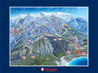
This year I got my season ski pass for Heavenly Ski Resort down in South Lake Tahoe. Tim Weigel, Shasta Ferranto and myself have teemed up to make up the tele mafia at Heavenly. There really aren't too many other tele skiers on the mountain so we're probably quite noticeable. I think this has been one of the leanest snow years for the Sierra Nevada on record. Certainly it is way below last year. As a result most of the skiing is pretty restricted to groomed runs with snowmaking, and this February! Actually, we did score a few decent tree shots but that was just after New Years.
My goal for the season is to get comfortable skiing moguls on tele skis. The rationale is that moguls will force me to be quick on my feet as well as force me to ski the fall line. Hopefully these two traits will come in handy in the woods and on the steeps. To date I've clocked 11 ski days this season, although some days were on alpine skis and not every day has been a full day.
Sunday, October 15, 2006
Autumn colors in Reno -
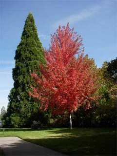

Fall has arrived in Nevada and even though we live in the desert there are abundant opportunities for viewing the colors. Whether hiking through aspen groves at Tahoe, mountain biking through canyons of cottonwoods, or basking in the afternoon sun on the UNR campus autumn colors are everywhere.
Photos from left to right: 1) Fiery red tree on the UNR campus 2) Leaves changing color 3) Fall activities
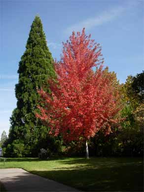

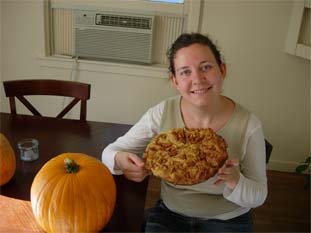
Fall has arrived in Nevada and even though we live in the desert there are abundant opportunities for viewing the colors. Whether hiking through aspen groves at Tahoe, mountain biking through canyons of cottonwoods, or basking in the afternoon sun on the UNR campus autumn colors are everywhere.
Photos from left to right: 1) Fiery red tree on the UNR campus 2) Leaves changing color 3) Fall activities
Monday, August 21, 2006
 Vacation in Oregon -
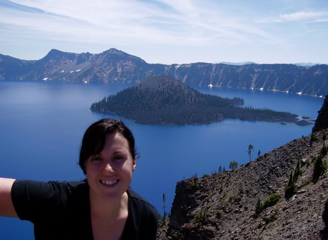
Last week I returned home from a family vacation in Oregon. My sister, Cara (that is her in the picture on the rim of Crater Lake), flew in from Washington D.C. to visit and we took the opportunity to do some fun stuff, like go to the beach at Lake Tahoe, and visit family. Cara, Holly, and I drove to Portland, Oregon and from there on to Seattle where we visited my brother, his wife, and my niece. It was Tyra's (my niece) fourth birthday.
From there it was back to Grand Ronde where my mom, grandparents, and uncle live. We had the opportunity to spend some of the days out on the Oregon coast, which must be one of the greatest coastlines in the world.
Then Holly flew back to Fairbanks to see her family and bring her dog Leif back to Reno. Finally, Cara and I did the drive back to Reno with a stopover at Crater Lake National Park (see the photo above). Crater Lake is truly one of the most spectacular lakes in the world. It is also the deepest lake in the United States, surpasssing even Lake Tahoe. It is also more blue than Tahoe. Cara then flew out to Vegas to visit my other sister Colleen.
Stay tuned for future posts on my new house and upcoming trips to the High Sierra.
Monday, July 24, 2006

Illuminated by science -
Those of you in Reno should check out my letter to the editor in this weeks Reno News and Review in response to the column Right Hook. Right Hook's author, Mike Lafferty, wrote a piece on global warming. In that article he cited the advance of the Hubbard Glacier as an apparent contradiction to global warming. (Must all glaciers be receeding simulataneously at the same rate to support the idea of global warming?) He also compared glacial melting to ice in a soft drink glass. Apparently he doesn't realize that there is land underneath Antarctica and most other places covered by glaciers.
Monday, July 17, 2006

Climbing at the Leap -
Since moving to Reno I've adopted Lover's Leap as my new home crag. After years of climbing at places such as Grapefruit Rocks and Angel Rocks in Fairbanks, Alaska I'm relieved and excited to have such high quality trad climbing around me.
For those of you not familiar with Lover's Leap it is one of the great traditional climbing areas of California. It is virtually a miniature Yosemite, apart from the fact that there are numerous granitic dikes that add features to the rock and make hard routes much more reasonable.
Newton DeBardeleben and I have been coming back here for three weekends in a row. This past weekend we were back to climb Travelers Buttress, a 4 pitch 5.9 crack climb on the Main Wall. The offwidth 5.9 pitch shut us down so we opted for the much more moderate classic next door, Corrugation Corner. Corrugation Corner is perhaps the most amazing 5.7 climb I've ever done. Newton believes it to be the steepest 5.7 he has done. We still aim to come back and finish Travelers Buttress, but perhaps with a little bit of offwidth training first.
-Tom
Tuesday, July 11, 2006
Professional website -
I've got a graduate student website now that talks about my research.
http://www.unr.edu/cos/geography/tdilts.html
-Tom
I've got a graduate student website now that talks about my research.
http://www.unr.edu/cos/geography/tdilts.html
-Tom
 Mount Shasta -
Mount Shasta simply dominates northern California. When I was moving to Reno in August 2005 I drove Highway 97 through Central Oregon and noticed a massive white mountain off in the distance. That vantage was from north of Klammath Lake over 50 miles away. Mount Shasta is big, beautiful, and covered with real glaciers. It is truly impressive. Naturally, I wanted to climb the mountain as soon as possible.
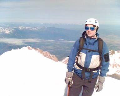 The first opportunity came during New Years 2005/2006 when Sean Bemis, Chris "Cri" Boratenski, and myself planned a winter ski trip to the mountain. Chris's fiancee Julia joined us, as did Jarrod and Sam Decker. On this first trip we were weathered out in a big way. Several feet of snow fell on the mountain. Julia, Sam, and Jarrod had to leave early and ended up getting stuck on the drive down the mountain. Meanwhile, Sean, Cri, and myself were sitting by the heater in Sean's van drying out before returning to Horse Camp. We did end up enjoying some good skiing on that and the trip that followed in March, however, the summit continued to beckon.
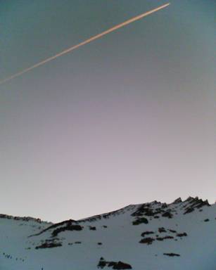 With Sean off doing geology fieldwork over the summer, Cri and I planned a summit attempt of our own in June. This would be my third attempt and Cri's fourth. We met up in San Fran on a Friday and drove up to the mountain during the evening only to find the parking lot packed. At about 9:30 pm we showed up at Horse Camp, pitched our tent, cooked dinner, and prepared for the 1:00 am start. Both of us forgot cameras so we took photos with Cri's cell phone.
That morning we awoke to several other parties with loud voices and loud footsteps within a few feet of our tent. We quickly mobilized by strapping on the skis and heading up the mountain in the dark. Dawn hit as we were ascending the headwall of the Avalanche Gulch route with a hundred other people. We stashed the skis and continued up past the Red Bank and up Misery Hill. Eventually we reached the summit just in time for the clouds to clear out and the winds to die down. Fortunately for me I felt no effects of altitude on this climb as I had on Mt. Whitney. We took it easy on the summit and on the descent we even caught a brief snooze on the lee side of a rock bank.
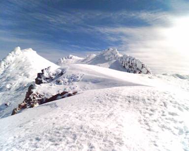 The ski descent down the lower mountain was simply amazing. The snow was perfect powder. We were happy that we had brought the skis, but at the same time we were glad that we hadn't hauled our skis to the summit where the snow was boilerplate crust. Everything on this trip had worked out quite well.
 Hopefully, some future trips to the mountain will include ascents of the West Face route and the north side routes. Shasta is the perfect halfway point for Sean, Cri, and myself, since Sean is living in Eugene, Cri in San Francisco, and I'm living in Reno.
-Tom
Link to SummitPost for route info:
http://www.summitpost.org/mountain/rock/150188/mount-shasta.html
Mount Whitney - 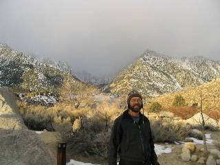
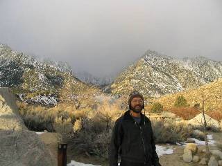
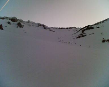
One of the first mountains that I wanted to climb upon moving to Reno was Mount Whitney. At 14,496 feet it is the highest in the lower-forty eight states. Also, it would be the highest elevation that my body had ever ascended to. Dave Walker, who is a fellow graduate student in geography at UNR, suggested climbing the peak. Neither of us wanted to deal with the crowds or the quota system that is imposed upon hikers during the summer months so we opted to climb the peak in January, 2006. This also gave us the opportunity to do a little bit of telemark skiing on the descent from base camp.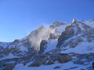 We left Reno for Lone Pine, California and stayed the night in a BLM campground near the Whitney Portal road. That is Dave in the photo with the Whitney Portal road ascending the hill behind him. That night we were rocked by strong winds but awoke to improved conditions.
Our climb began a little before the trailhead since the road is closed in winter. That day we ascended to trail camp, at 12,039 feet and pitched our camp. At -10 F it felt just like an Alaskan climb. We pitched our tent in the lee of an outhouse for protection from the wind.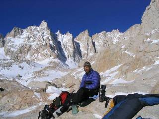 The following morning we awoke to conditions that couldn't be better and went for a summit attempt. The morning sun barely poked its head over the mountains to the southeast, but gave us a jolt of energy. We put our skis on and headed for the col where the summer hiking trail reaches trail crest at 13,777.
The ridgeline teated us to gorgeous views of the Sequoia and Kings Canyon National Park to the west and vast areas of wilderness. In January there were no other people around to disturb our solitude apart from the military fighter jets that buzzed overhead ever 5 to 10 minutes. I have to admit that low flying aircraft truly is one of the biggest impositions on one's wilderness experience. Nonetheless, there would be no wilderness experience in the summer due to the crowds, so I suppose that we were fortunate in that regard. Trail ridge is where I began to feel the effects of altitude. My body had never been that high before and such a lengthy traverse at that altitude had me slowing to a crawl. We proceeded up the amount, albeit slowly. Not once did we have to don crampons, however I certainly was glad to have an ice ax in my hand. Although non-technical the route had several sections where a fall could have resulted in injury.
 At the end of the day we reached the stone hut on the summit. We didn't have much time to linger, however, and quickly started on the descent. We hurried as quickly as we could at that altitude along the traverse but darkness caught us by the time we reached our skis and we were forced to ski down in the dark. I lost a skin on the descent, which I didn't discover until too late. We were tired and exhausted, but where was the tent? The tent and the outhouse were tucked away amongst the rocks and in the darkness everything looked alike. After over an hour of searching we found the tent and cooked ourselves dinner.
The next morning Dave and I set out looking for my lost ski skin, but to know avail. We shoved off from camp with loaded packs and skied down to the trailhead. The conditions above treeline were horrendous. Wind blown crust alternated with small pockets of powder. Once we dipped below treeline conditions improved and the skiing was remarkable. Finally, the trail narrowed into a thick forest canopy where the surface was littered with branches and needles. These conditions proved tricky. Around noon we returned to the car, took a look back at the peak, and counted ourselves lucky. What a great climb!
 -Tom
-Tom
Link to summitpost for route information: http://www.summitpost.org/route/156374/whitney-trail.html
Subscribe to:
Posts (Atom)